Description —
The city consists of many related and interconnected networks from the global to the quotidian. While these are frequently studied at a distance, this course advocates for the importance of getting close to urban experiences to understand how a city is made and remade. Using the selected city (from design studio) as a case study this course uses mapping as an operational instrument within the design process to further our understanding of the urban realm to uncover narratives about the territorial and everyday life of the city.
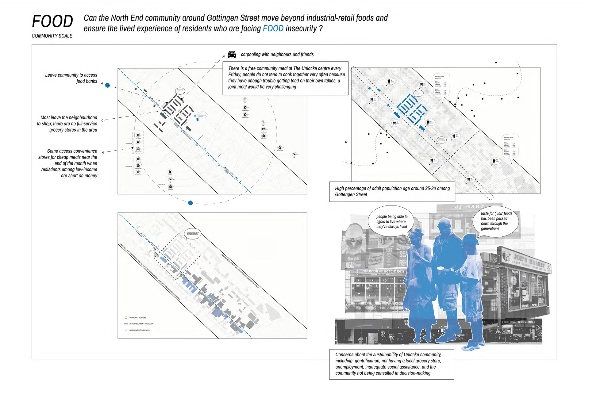
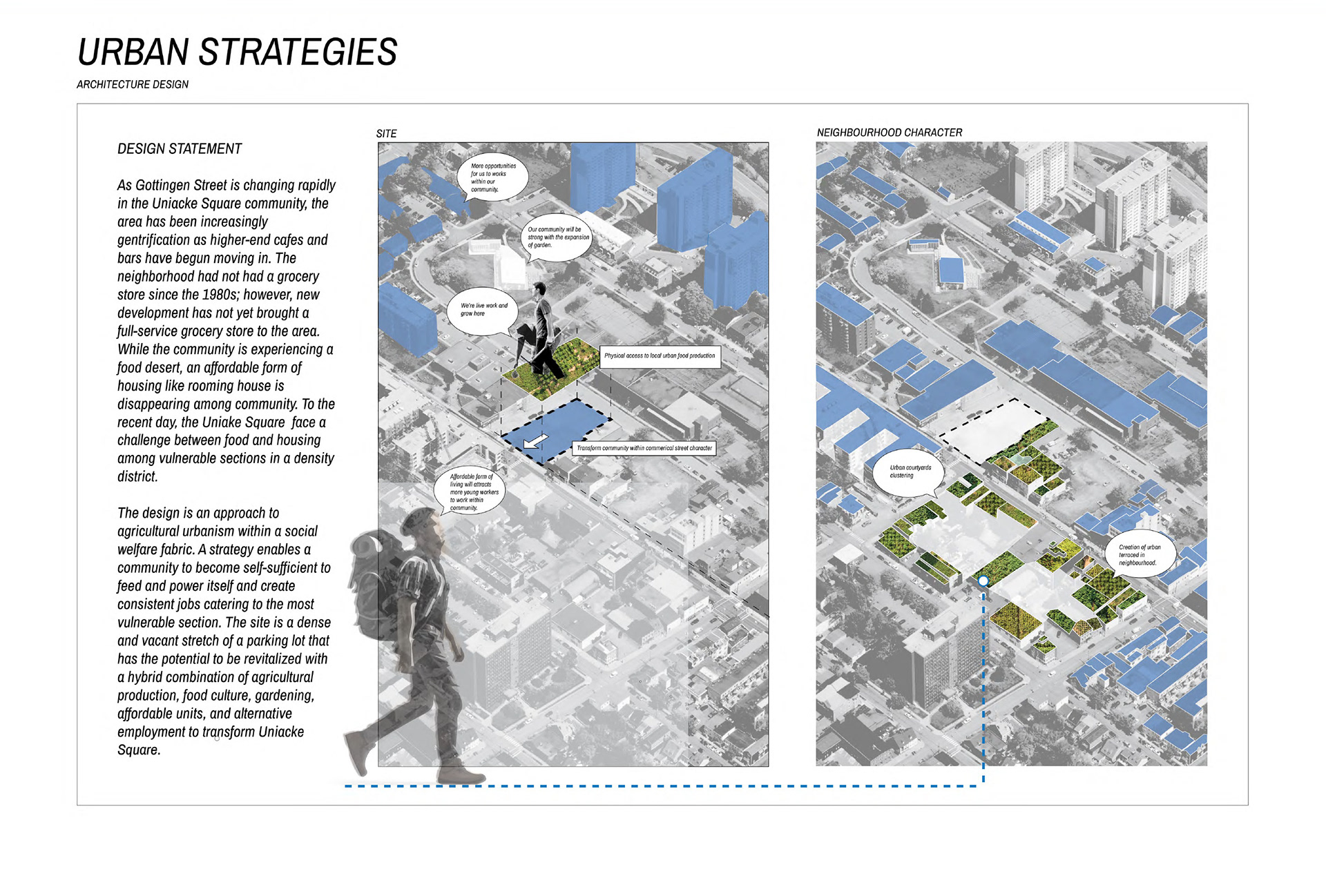
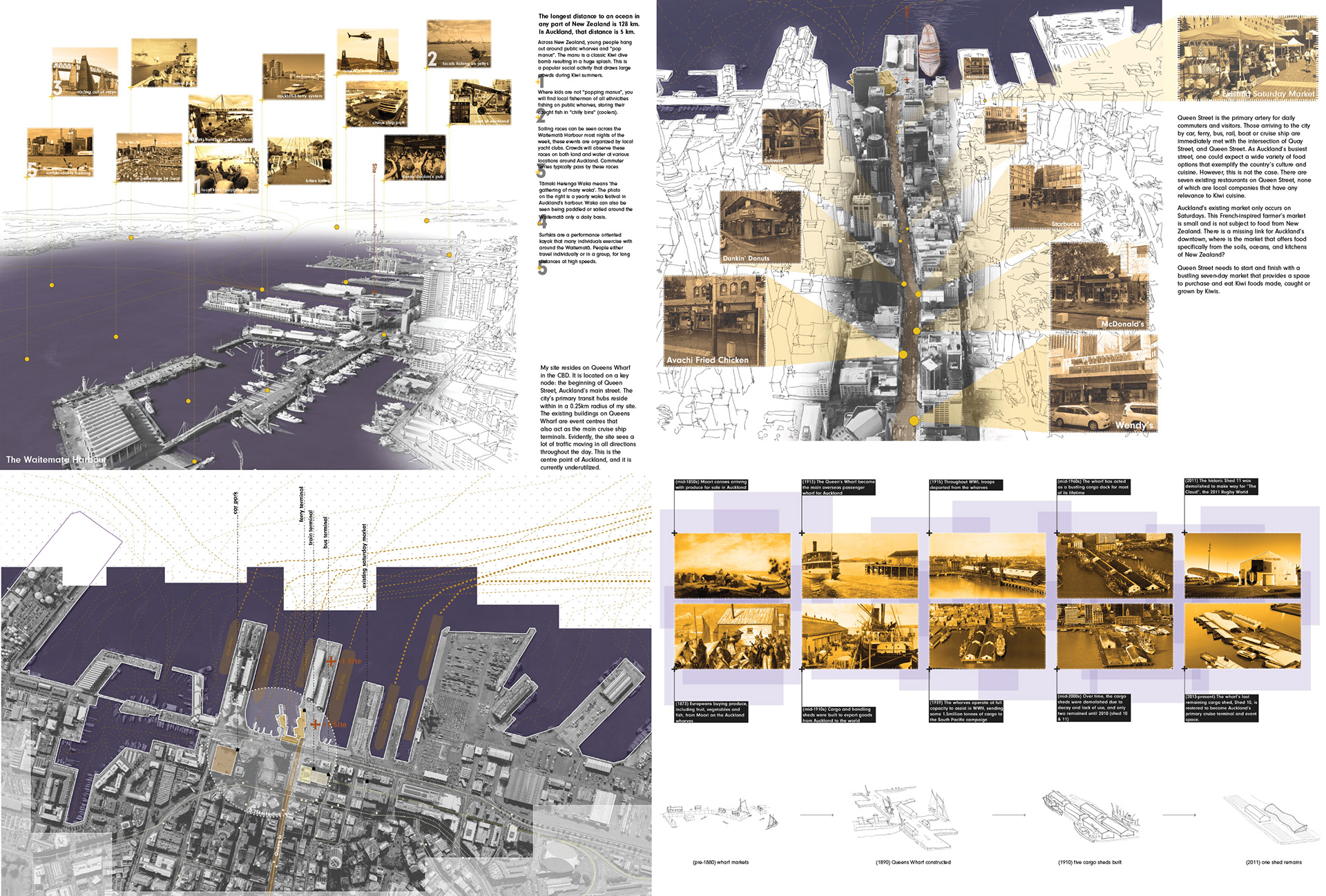
Maps often delineate geographies, resources, and ownership and give importance to certain aspects of our cities, communities and cultures, and reject others. We will use the map in multiple ways to uncover inequities, divisions, and in betweens. We will expose these conditions and then present the possibilities for the emergence of new urban futures. Acts of mapping are creative, sometimes anxious, moments in coming to knowledge of the world, and the map is both the spatial embodiment of knowledge and a stimulus to further cognitive engagements. Denis Cosgrove Working at the scale of the territory, community, street, and human body, students will learn new skills of mapping to investigate sites within their selected city. Working in multiple ways and at different scales students will interpret and situate their work within the physical, social, economic, and ecological context to more fully understand the possibilities for design.
This class specifically focuses on developing methods for understanding the intersections of everyday life to inform research of the city. It uses this understanding to develop a well grounded design proposition that studies the past and present findings in the city to design for the future. In addition, this course helps develop a clear method for students to position their work and research for thesis.
Student Work: Tai Nguyenha, Carri Ko, Will Mclnnes (2022)